Oil Reservoir Monitoring
- Subheading: Oil reservoir deformation monitoring
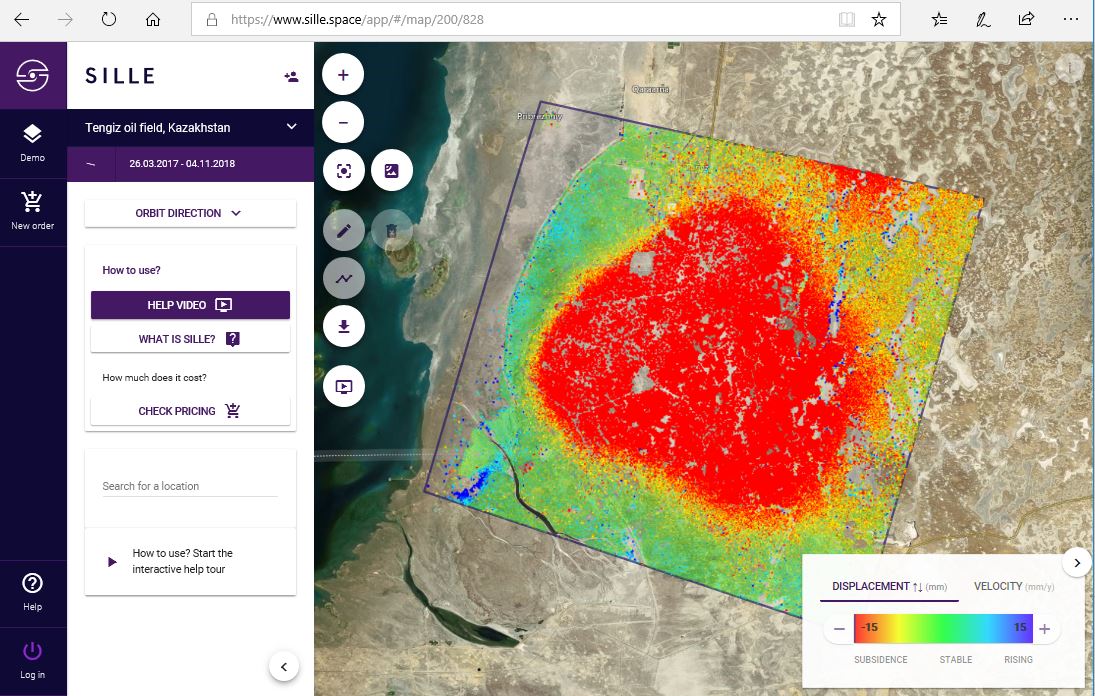
Oil reservoir deformation monitoring in the Tengiz oil field, Kazakhstan.
Case Study Background
Discovered in 1979, the Tengiz oil field is the sixth-largest oil field in the world, located in northwestern Kazakhstan's low-lying wetlands along the northeast shores of the Caspian Sea. It covers a 2,500 km2 (970 sq mi) area, stretching 19 km (12 mi) wide and 21 km (12 mi) long. The Tengiz oil field is one of the better-researched fields with interferometric synthetic aperture radar (InSAR) technology. InSAR is increasingly used for monitoring ground deformation over oil and gas reservoirs, achieving greater spatial coverage than traditional field-based surveying techniques.
Changes in subsurface pore pressures and stresses due to the extraction of hydrocarbons often cause deformation over oil and gas fields. This can have significant consequences, including ground subsidence, induced seismicity, and well failures. Geodynamic monitoring is an important requirement in recognizing potential threats ahead of time, for remedial measures to be implemented. Sentinel-1 data reveals significant evolution of deformation over the field in 2016–2017, with subsidence increasing dramatically to a maximum of -79.3 mm/year.
SILLE advantages

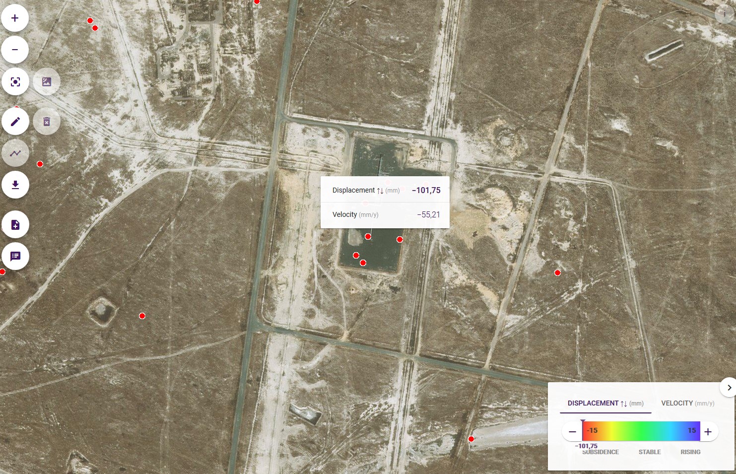
Analysis results from Sille: The majority of the area is subsiding (indicated in red). Attention should be directed to objects where the subsiding speed is different from the general subsiding speed of the area.
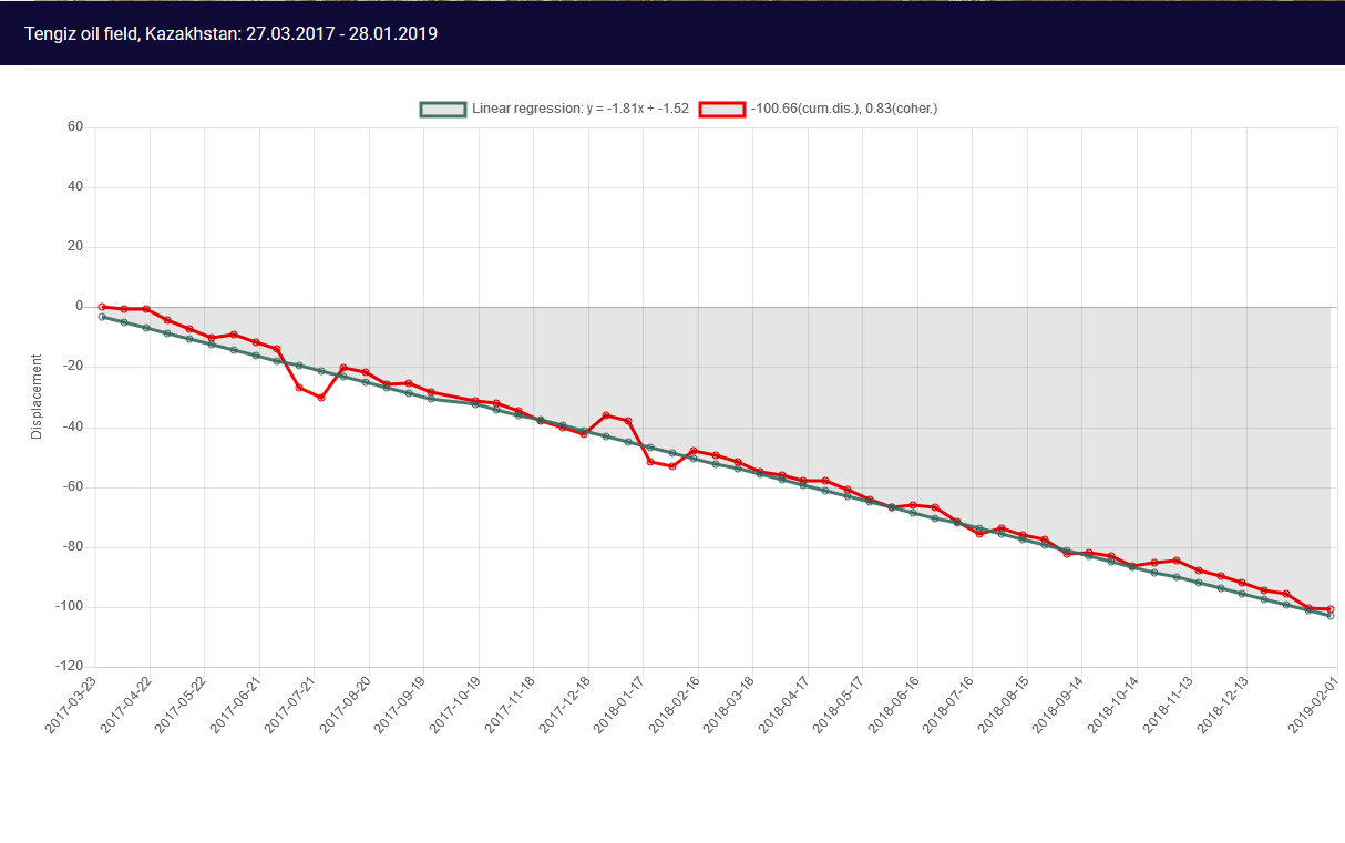
Subsidence can be related to oil extraction and a long term time series can indicate when and how much oil was pumped out. Below is an example from the oil field. The graph shows that the total subsidence level based on almost 2 years of SAR data is 100 mm (55 mm/year).
This type of analysis is useful for monitoring hazardous regions and looking back in time (6 years) how much objects and surface-levels have deformed. Results can be used to plan further actions to prevent damage to infrastructure and people.
Oil reservoir deformation monitoring in Tengiz oil field, Kazakhstan, refinery. Source: sille.space
SILLE Risk & Resource Savings
- Improve understanding of structural and ground motion
- Minimize the costs of corrective efforts through early vulnerability detection
- Efficiently monitor a large area for millimeter movements
- Reconstruct deformation for a better understanding of weaknesses
Case Studies
Levelling-benchmarks
Use of Sille.space, City of Tallin...
Levelling-benchmarks Tallinn, Estonia Case BackgroundThe complementary use of satellite radar interferometry (InSAR) with traditional systems has be...
Read moreTailings Dam Monitoring
Sille.Space assessments could have...
Newcrest’s Cadia Hill gold mine tailings dam, Australia. Continuing with our case-study series, in 2018, a section of Newcrest’s Cadia Hill gold ...
Read moreUnderground mine
Mining sites, surrounding infrastr...
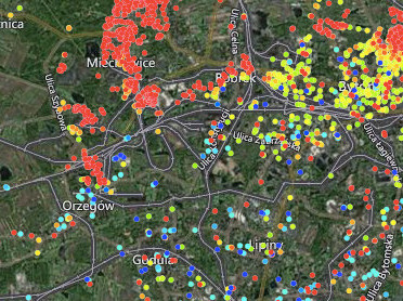
Bytom & Chełm Śląski, Poland Case Background Poland mines millions of tons of coal every year accounting for just over half of the country's ene...
Read moreTunneling Monitoring
Wide area monitoring
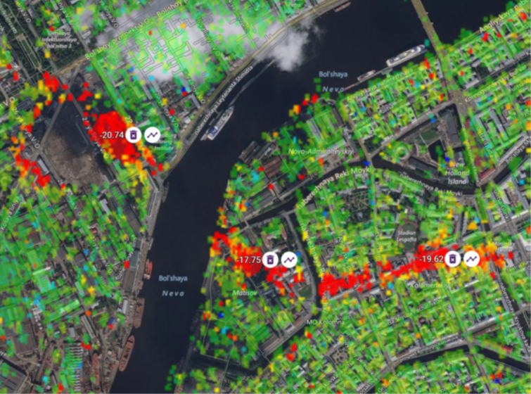
Tunneling monitoring, Saint Petersburg, Russia Case Study BackgroundMonitoring surface deformation to ensure the stability and safety of the undergro...
Read moreLand Subsidence Monitoring
Wide Area monitoring, City, Port,....
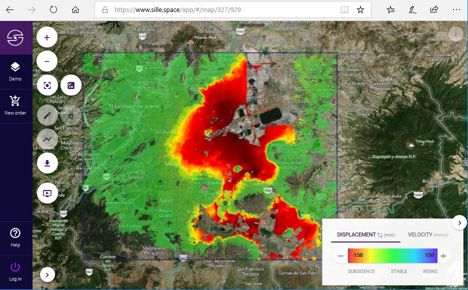
Long-term land subsidence in Mexico City Case Study Background Land subsidence is one of the main hazards in engineering and construction. Urban lan...
Read moreOil Reservoir Monitoring
Oil reservoir deformation monitori...
Oil reservoir deformation monitoring in the Tengiz oil field, Kazakhstan. Case Study Background Discovered in 1979, the Tengiz oil field is the sixt...
Read more