Tunneling Monitoring
- Subheading: Wide area monitoring
Tunneling monitoring, Saint Petersburg, Russia
Case Study Background
Monitoring surface deformation to ensure the stability and safety of the underground, as well as above-ground infrastructure, is fundamental for mitigating risks related to tunneling projects during all phases, from design to construction and operation. The complementary use of satellite radar interferometry (InSAR) with traditional systems has been successfully applied in tunneling projects worldwide. The wide coverage and high density of information provided remotely by advanced InSAR techniques is not achievable with in-situ instrumentation.
The historical satellite data provides a ground deformation baseline (e.g. identification of pre-existing ground movement) and contributes to assessing the impact of tunneling activities.
Saint Petersburg Metro.
Due to the city's unique geology, the Saint Petersburg Metro is one of the deepest metro systems in the world and the deepest by the average depth of all the stations.
One of the recent developments in Saint Peterburg’s Metro was the extension of line 4 or the orange line (also known as Pravoberezhnaya Line) to the west.
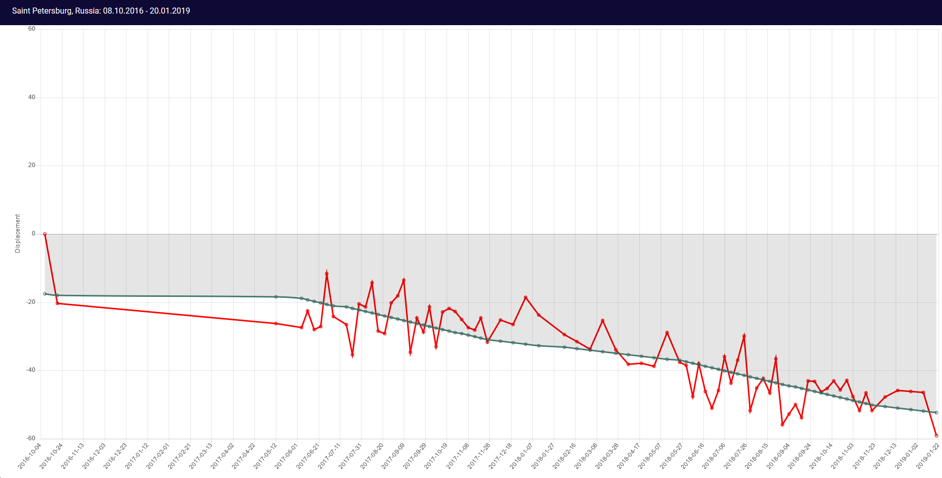
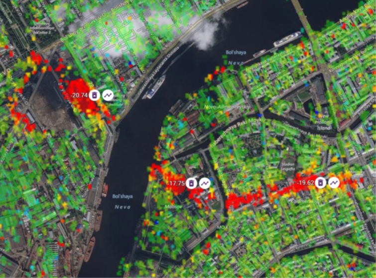
From Sille’s analysis, we can clearly see the location of the new extension of line 4 that starts from the Mariinsky Theatre. Almost two years’ worth of Sentinel 1 data time series shows how the ground above (and also buildings on top of it) are subsiding due to the construction work.

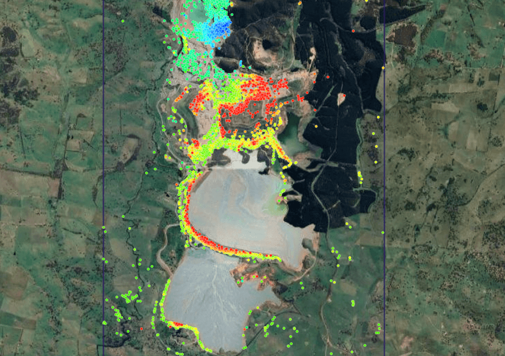
Sille’s analysis shows the distribution of the measurement points identified with InSAR, color-coded according to the average displacement rate measured during 12.05.2017- 20.01.2019. The new extension of metro line 4 is clearly visible (in red). Source: sille.space
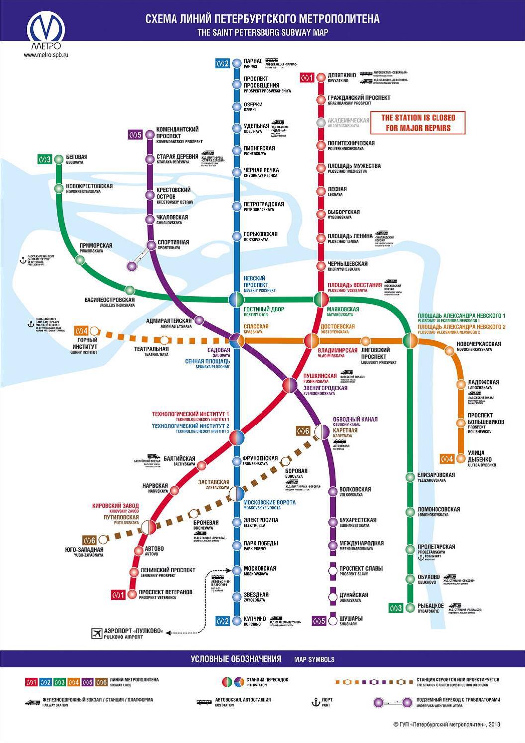
St Petersburg Metro map. Orange dotted line is the extension of line 4. Source: http://www.metro.spb.ru/en/
Example from the area where deformation occurs above the new metro line 4 extension. It is clearly visible that the area is subsiding over time. Source: sille.space
Satellite-based Early Warning System SILLE, Risk & Resource Savings
- Efficiently monitors a wide area for millimeter movements minimizing survey times and costs
- Regular monitoring of operational infrastructure supports the maintenance program, helping identify possible structural weaknesses or damage, and provides an early warning of possible accelerations in deformation.
https://www.sille.space/app/#/map/218/545
Case Studies
Levelling-benchmarks
Use of Sille.space, City of Tallin...
Levelling-benchmarks Tallinn, Estonia Case BackgroundThe complementary use of satellite radar interferometry (InSAR) with traditional systems has be...
Read moreTailings Dam Monitoring
Sille.Space assessments could have...
Newcrest’s Cadia Hill gold mine tailings dam, Australia. Continuing with our case-study series, in 2018, a section of Newcrest’s Cadia Hill gold ...
Read moreUnderground mine
Mining sites, surrounding infrastr...
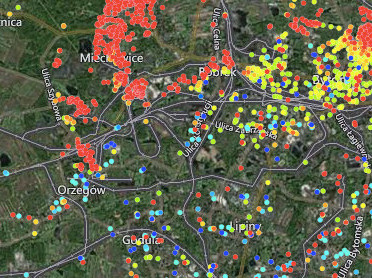
Bytom & Chełm Śląski, Poland Case Background Poland mines millions of tons of coal every year accounting for just over half of the country's ene...
Read moreTunneling Monitoring
Wide area monitoring
Tunneling monitoring, Saint Petersburg, Russia Case Study BackgroundMonitoring surface deformation to ensure the stability and safety of the undergro...
Read moreLand Subsidence Monitoring
Wide Area monitoring, City, Port,....
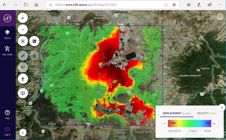
Long-term land subsidence in Mexico City Case Study Background Land subsidence is one of the main hazards in engineering and construction. Urban lan...
Read moreOil Reservoir Monitoring
Oil reservoir deformation monitori...
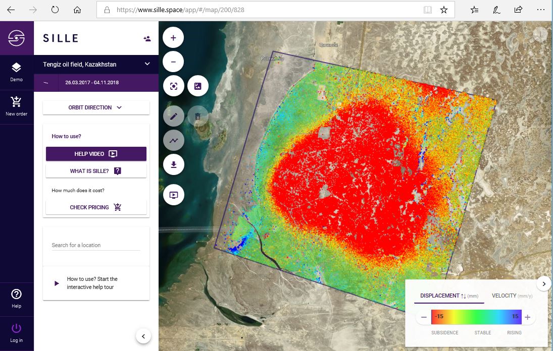
Oil reservoir deformation monitoring in the Tengiz oil field, Kazakhstan. Case Study Background Discovered in 1979, the Tengiz oil field is the sixt...
Read more