
Monitoring of Unauthorized Minings
- Subheading: Detection of illegal minings
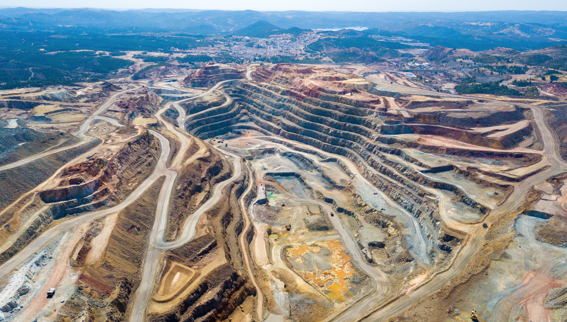
We help to detect potential mining activities using high-resolution optical satellite imagery and advanced geospatial analysis algorithms. This solution provides a rapid, data-driven approach to environmental monitoring and mining supervision.
Core Objectives
- Identify visible land surface characteristics indicative of mining (e.g., exposed soil, excavation patterns, access roads).
- Support regulatory bodies and organizations in understanding how satellite technology can enhance compliance and supervision workflows.
- Streamline the identification of candidate areas for further inspection or verification.
Analysis Capabilities
The AS Datel algorithm analyzes spectral and spatial patterns to detect:
• Exposed soil and disturbed land.
• Quarry-like shapes and extraction areas.
• Infrastructure like stockpiles, sediment ponds, and service roads.
• Land-use changes typically associated with open-pit mining.
• Optional Upgrade: Digital Register Integration
We can also integrate your official digital mining register or permit database via API.
This enables:
• Gap Analysis: Detecting mining areas not present in official registers.
• Boundary Monitoring: Identifying activity extending outside permitted zones.
• Compliance Support: Flagging unregistered or incorrectly mapped sites.
AS Datel launched Sille.space- an early warning and structural health monitoring e-service in April 2018. The early warning system uses data from satellites to detect the shifts and subsidence of infrastructures such as dams, bridges, railroads, pipelines, port areas, mines, and large buildings with a precision of up to 2 mm.
Sille.space offers a proactive tool for structural integrity monitoring and disaster prevention. Satellite monitoring can identify subsidence and structural defects that are otherwise undetectable.
Interferometric synthetic aperture radar (InSAR) is an active remote-sensing technology that emits microwave impulses towards the ground, with the satellite sensor registering all those that are backscattered or returned.
Sille.space can be used to monitor objects that reflect well, such as hard surfaces like rocks, artificial objects, metal, etc. To collect and calculate deformation data, the satellite emits a radar wave targeted to a structure on Earth and the phase is measured. During the next satellite pass, the process is repeated and a new phase is measured. Then the difference between the two phases is calculated and the difference is found, to enable identification of any deformation.
Case Studies
Underground mine
Mining sites, surrounding infrastr...
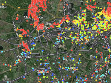
Bytom & Chełm Śląski, Poland Case Background Poland mines millions of tons of coal every year accounting for just over half of the country's ene...
Read moreOil Reservoir Monitoring
Oil reservoir deformation monitori...
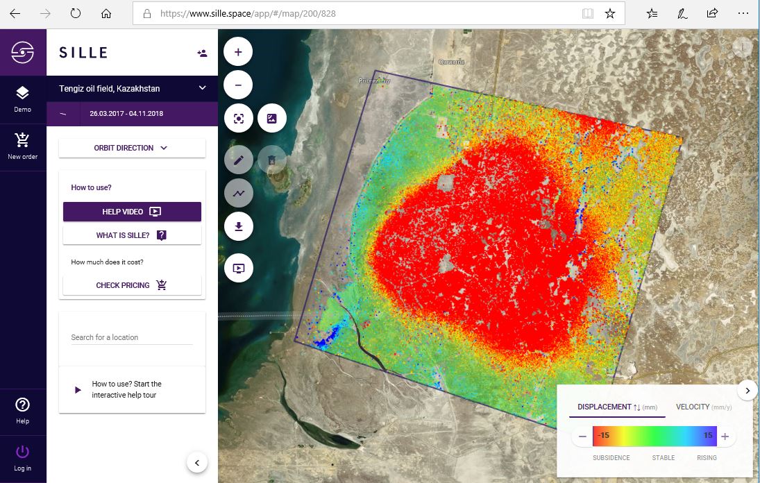
Oil reservoir deformation monitoring in the Tengiz oil field, Kazakhstan. Case Study Background Discovered in 1979, the Tengiz oil field is the sixt...
Read moreLand Subsidence Monitoring
Wide Area monitoring, City, Port,....
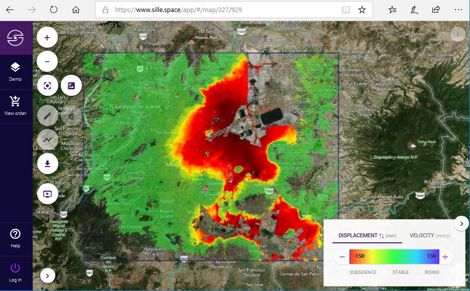
Long-term land subsidence in Mexico City Case Study Background Land subsidence is one of the main hazards in engineering and construction. Urban lan...
Read moreTunneling Monitoring
Wide area monitoring
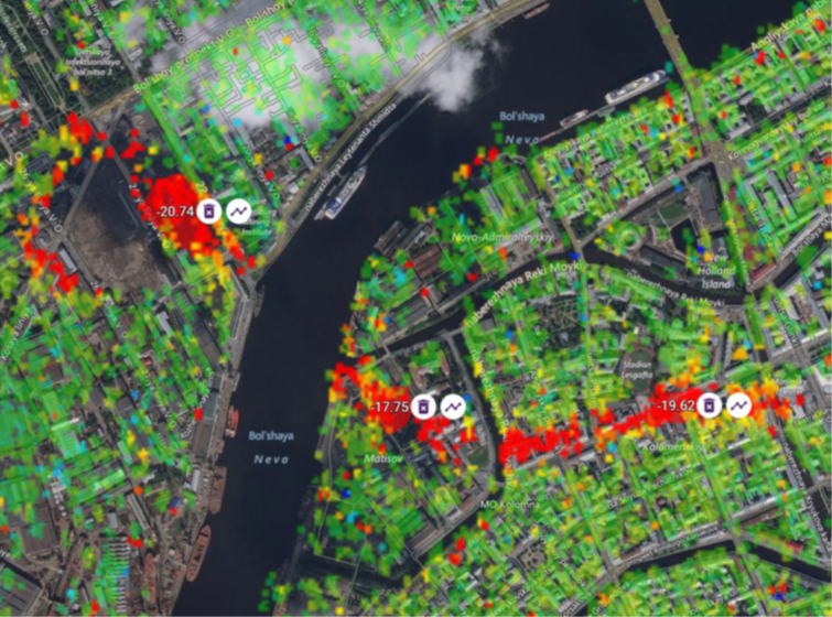
Tunneling monitoring, Saint Petersburg, Russia Case Study BackgroundMonitoring surface deformation to ensure the stability and safety of the undergro...
Read moreTailings Dam Monitoring
Sille.Space assessments could have...
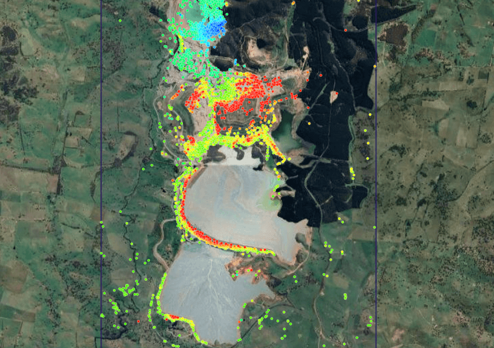
Newcrest’s Cadia Hill gold mine tailings dam, Australia. Continuing with our case-study series, in 2018, a section of Newcrest’s Cadia Hill gold ...
Read moreLevelling-benchmarks
Use of Sille.space, City of Tallin...
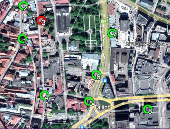
Levelling-benchmarks Tallinn, Estonia Case BackgroundThe complementary use of satellite radar interferometry (InSAR) with traditional systems has be...
Read moreMonitoring of Bridges
Satellite monitoring reveals signi...
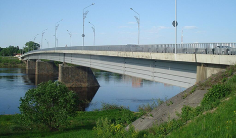
The Vienības Bridge in Daugavpils, Latvia, is an approximately 300-metre-long road bridge spanning the Daugava River and serves as a critical transpor...
Read moreMonitoring of Unauthorized Minings
Detection of illegal minings
We help to detect potential mining activities using high-resolution optical satellite imagery and advanced geospatial analysis algorithms. This soluti...
Read more